NASA’s Terra satellite flew over Tropical Storm Chanthu as it continued moving past the big island of Japan and staying to the east of the country.
On August 15 at 11:00 a.m. EDT (15:00 UTC) the Joint Typhoon Warning Center (JTWC) indicated that Chanthu was located about 424 nautical miles south-southeast of Yokosuka, Japan, near 29.6 degrees north latitude and 143.3 degrees east longitude.
Chanthu was moving to the north-northwest. Maximum sustained winds were near 46 mph (40 knots/74 kph). Slight intensification is forecast.
On August 15 the Moderate Resolution Imaging Spectroradiometer aboard NASA’s Terra satellite captured a visible image of Tropical Storm Chanthu when it was east of the big island of Japan.
The strongest thunderstorms appeared in a band north and northwest of the center of circulation. Fragmented bands of thunderstorms wrapped into the low-level center from the south and east.
Chanthu was previously known as Tropical depression 09W. Island, Japan on Aug. 13.
JTWC forecasts Chanthu to track north, and skirt the northeastern coast of the big island, then make landfall on Aug. 17 in south central Hokkaido, Japan’s northern most island.
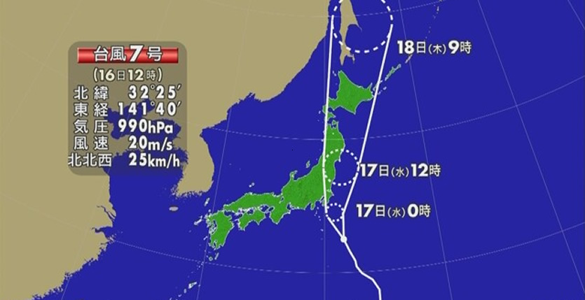
Source: News on Japan (phys.org)
Image: NHK


Join the Conversation